|

Library >>
Renewable Energy Resource
Maps >> Africa
>> Geothermal >>
Morocco
Geothermal Energy in Morocco
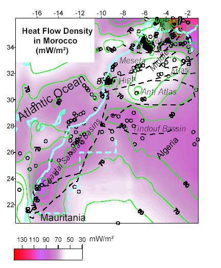
Heat flow density contours surimposed
on the structural sketch of Morocco
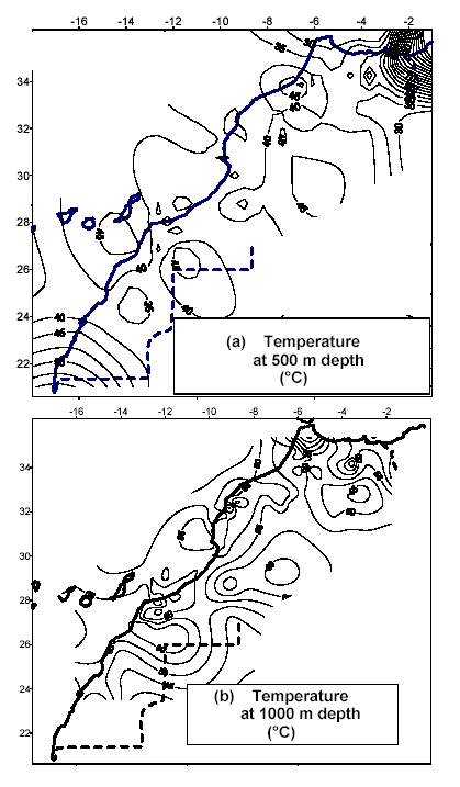
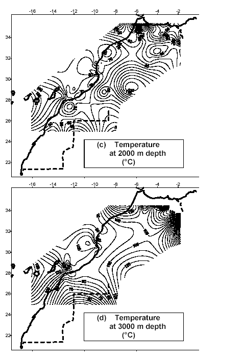
Temperature contours (�C) at 0.5
km beneath the surface (a), at 1 km depth (b), at
2 km depth (c) and at 3 km depth (d)
Zones with geothermal resources potential
in Morocco
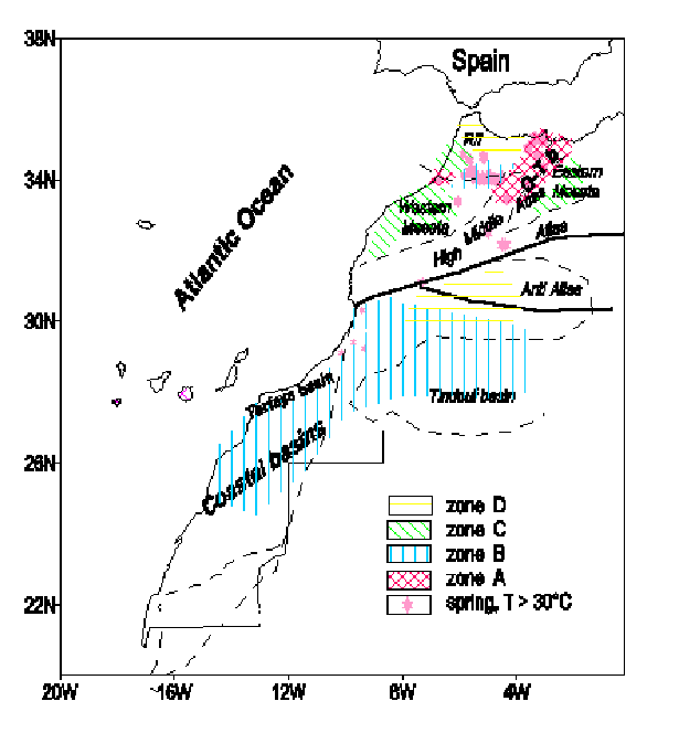
The Moroccan underground contain geothermal
potentialities, mainly low grade energy. The maps
of heat flow density and the temperatures distribution
down to 3000 m depth, are drawn and area of geothermal
resources are defined by the estimation of the heat
in place. The more promising regions are northeastern
Morocco and the sedimentary basins in the Sahara.
Countries
Algeria | Angola
| Burkina Faso | Benin | Botswana | Burundi | Cameroon
| Cape Verde | Central African Republic | Chad | Comoros
| Congo | C�te d'Ivoire | Djibouti
| Equatorial Guinea | Eritrea
| Ethiopia | Gabon
| Gambia | Ghana | Guinea | Guines-Bissau | Kenya
| Lesotho | Liberia | Lybia | Madagascar | Malawi
| Mali | Mauritania | Mauritius | Morocco | Mozambique
| Namibia | Niger | Nigeria | Rwanda | S�o Tom� and
Pr�ncipe | Senegal | Seychelles | Sierra Leone | Somalia
| South Africa | Sudan | Swaziland | Tanzania
| Togo | Tunisia | Uganda
| Zambia | Zimbabwe
Related GENI Resources
Links
AFREC
(African Energy Commission)
AFREPREN/
FWD - Energy, Environment and Development Network
for Africa
WEC
- Energy Geography of Africa
African
Development Bank Group (ADFB)
|
Email
this page to a friend
Updated: 2016/06/30
If you speak another language fluently and you liked this page, make
a contribution by translating
it! For additional translations check out FreeTranslation.com
(Voor vertaling van Engels tot Nederlands)
(For oversettelse fra Engelsk til Norsk)
(Для дополнительных
переводов проверяют
FreeTranslation.com )
 Map")